Full Text:
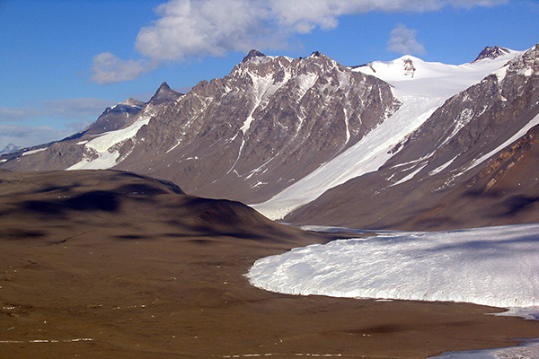
Researchers funded by the National Science Foundation have publicly released high-resolution maps of Antarctica's McMurdo Dry Valleys, a globally unique polar desert. The high-resolution maps cover 3,564 square kilometers of the McMurdo Dry Valleys and allow researchers to compare present-day conditions with lower-resolution LIDAR surveys conducted almost 13 years ago.
The new research project mapped the area using sophisticated LIDAR, a remote-sensing method that uses laser beam pulses to measure the distance from the detector to the Earth's surface. The data, collected by aerial survey missions flown in the Southern Hemisphere in the summer of 2014-2015, provide detailed topography of the perpetually ice-free region, where surprising landscape changes, such as rapid erosion along some streams, have been observed in recent years.Image credit: David Haney, NSF