Summary:
adsf
Full Text:
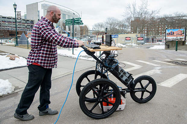
Digging a hole in most major cities -- for new construction or infrastructure repair -- is no minor undertaking. It can require a dozen or more separate utilities to inspect the ground under the dig site for a welter of obstructions, such as water, sewer and gas pipes, electric lines and electric generators -- some so old they don’t appear on city maps.
The permitting process can take 18 months or more. Thanks in part to a US Ignite grant, National Science Foundation-funded researchers are refining an advanced ground penetrating radar, or GPR, system that can peer deep underground to detect buried infrastructure, some of it dating to the mid-19th century, and create scans of what it sees. The researchers are able to locate scans in a geographic space the program can remember and knit them together into a map -- the cognitive part of the project -- by using a common 3-D scanning smartphone app. The phone then converts the grainy radar scans to clearly recognizable, nuanced, 3-D objects using augmented reality software, commonly used for video game development. The researchers hope that the technology could enable inspectors to use augmented reality goggles or a specially equipped wireless device to walk over a designated area, look into the device, and see underground obstacles in detail.Image credit: Brian Jenkins
